<
  • <video id="wzk35"><input id="wzk35"></input></video>
    1. <u id="wzk35"></u>

    <video id="wzk35"><small id="wzk35"><kbd id="wzk35"></kbd></small></video>
  • <source id="wzk35"><small id="wzk35"><kbd id="wzk35"></kbd></small></source>
  • <u id="wzk35"><address id="wzk35"></address></u>

    <b id="wzk35"><address id="wzk35"></address></b>
    1. <u id="wzk35"><video id="wzk35"></video></u><b id="wzk35"><address id="wzk35"></address></b><u id="wzk35"><video id="wzk35"></video></u>
      ×
      請在電腦瀏覽器上訪問
      https://web.gstarcad.com/sharedLibrary/

      合作伙伴產品

      浩辰CAD與合作伙伴攜手,提供更為優質應用開發軟件。

      GeoWin DTM

      This is a digital terrain model program, and can run on GstarCAD. GeoWin DTM creates TIN from set of unordered points. User can creates contour lines or smoothed surface in sketch from TIN, creates profiles from section of TIN, define breaklines etc.

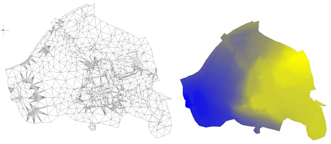
      1.Triangulated network (TIN)

      Function creates TIN from set of points. User has the option to define breaklines.

      2. Longitudinal / Cross section profile

      Creates a profile from section of TIN. At first, function requests your choice, whether you want New profile or Select 3D curve. If you select New profile, then you must specify the type of surface, from which you want to create the profile: TIN / 3D surface.
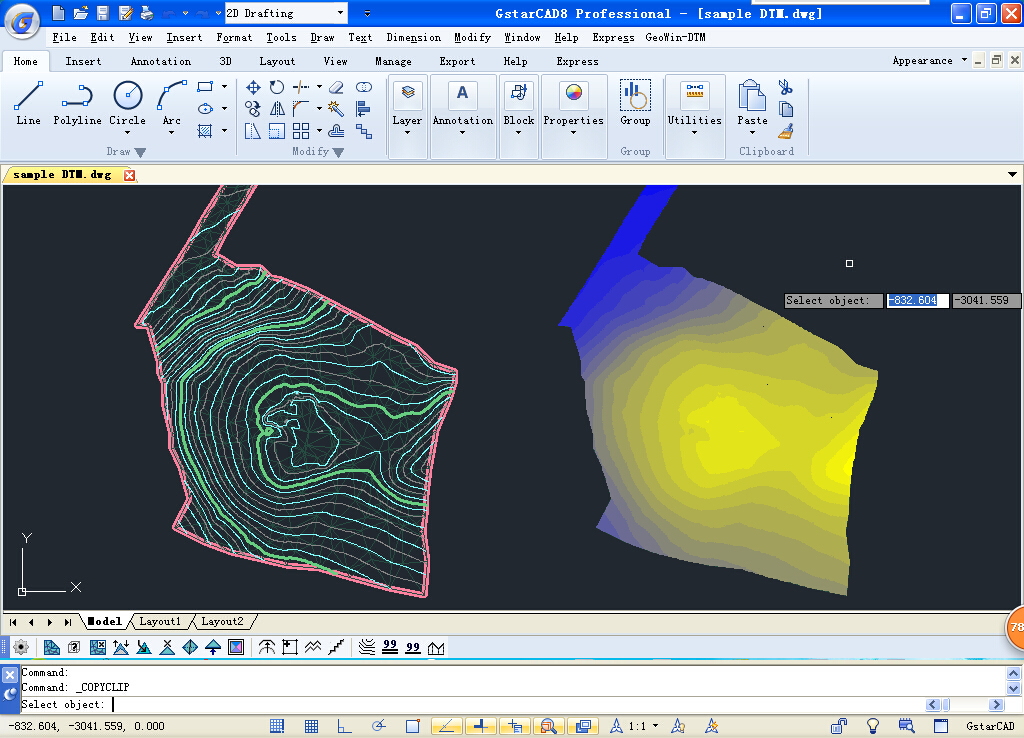
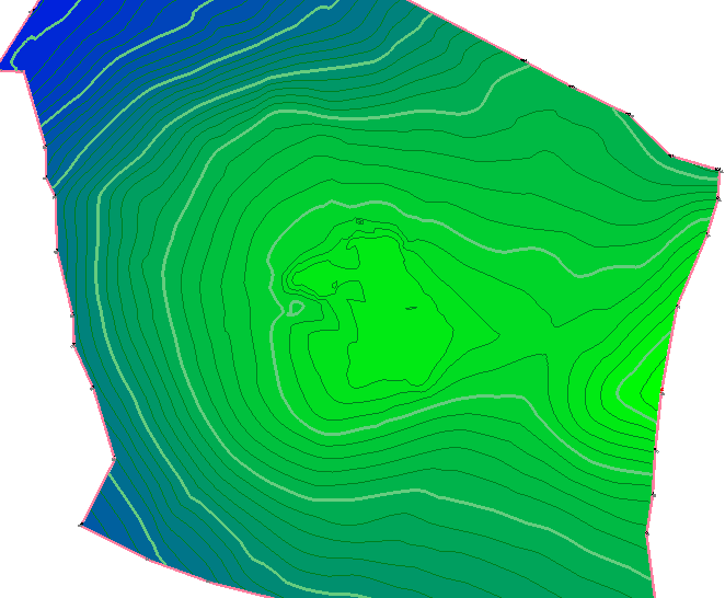
      3. Contours

      Creates contour lines or smoothed surface in sketch from TIN. User must select already created TIN, then, this window pops-up.

      4. Volume calculation

      Calculates volumes between two TINs, or between TIN and a comparative plane. The main model of the terrain is able to be refined (reduced) by closed curve. Then, only the volume of this area is calculated. Calculation shows volume above and under comparative plane (model). The calculation can be saved into a file.

      5. Editation of TIN

      Users can operate Correction of vertex-height of TIN, Removal of TIN vertex, Removal of triangles from TIN (hole), Adding a vertex to TIN, 3D offset of line, Transfer arc to 3D curve, Transfer of line segments to closed 3D curve, Determination of point height in TIN, Curve simplification to edit TIN.

      6. Color gradient fill

      Fills the triangular mesh (TIN) with 2 color gradient (object type hatch) in 3D space. In Settings, GeoWin-DTM can define a color for the lowest and the highest point of the mesh. The function then interpolates the individual triangles and colors.

      3 Pages
      GeoWin DTM
      • 語言
      • Czech
      • 運行環境
      • Windows7/8/10
      • 軟件大小
      • 0b
      • 發布日期
      • 2018-10-25
      • 出版者
      • http://www.geowin.cz/
      GeoWin DTM
      GeoWin DTM
      GeoWin DTM
      Copyright © 1992-2021 蘇州浩辰軟件股份有限公司 版權所有 蘇ICP備12077906號 增值電信業務經營許可證: 蘇B2-20210241 蘇公網安備 32059002004222號
    2. <video id="wzk35"><input id="wzk35"></input></video>
      1. <u id="wzk35"></u>

      <video id="wzk35"><small id="wzk35"><kbd id="wzk35"></kbd></small></video>
    3. <source id="wzk35"><small id="wzk35"><kbd id="wzk35"></kbd></small></source>
    4. <u id="wzk35"><address id="wzk35"></address></u>

      <b id="wzk35"><address id="wzk35"></address></b>
      1. <u id="wzk35"><video id="wzk35"></video></u><b id="wzk35"><address id="wzk35"></address></b><u id="wzk35"><video id="wzk35"></video></u>
        78aiav